


DETROIT The first round of light snow moved into southeast Michigan this morning and is expected to taper off around noon, according to the National Weather Service in Detroit. Forecasters say most areas will see anywhere from a coating to 2 inches of accumulation today, with the highest totals toward the Tri Cities and Thumb region. Patchy freezing drizzle is also possible.
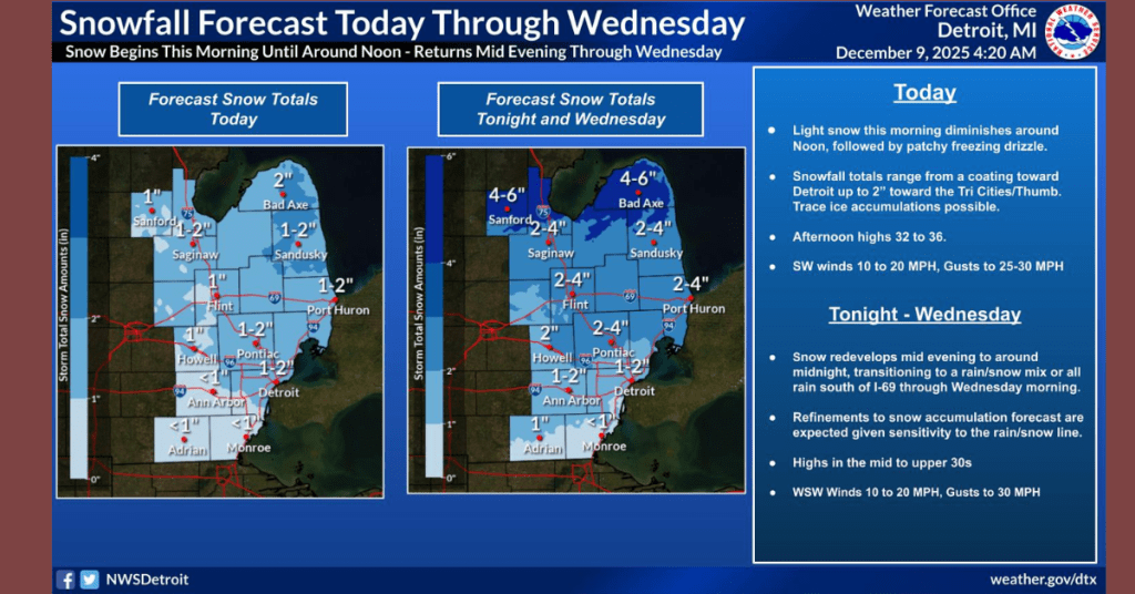
Afternoon highs are forecast to reach 32 to 36 degrees, with southwest winds between 10 and 20 mph and gusts up to 30 mph.
A second, more impactful round of snow is expected to redevelop mid evening and continue into Wednesday. The National Weather Service says some areas north of I 69 may see 2 to 4 inches of snow, while a rain and snow mix or even all rain is possible farther south. Forecasters note that the exact position of the rain and snow line could shift, which may lead to further adjustments in snow totals.
Highs on Wednesday will reach the mid to upper 30s, with west southwest winds of 10 to 20 mph and gusts up to 30 mph.