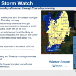


MID-MICHIGAN – The first significant snowstorm of the winter season could hit Mid-Michigan between Wednesday evening and Thursday morning, with meteorologists issuing alerts for potential heavy snow accumulation across the region.
While snowfall estimates are beginning to take shape, forecasters say it is still too early to provide exact totals as the storm remains distant. Multiple weather models show a low-pressure system expected to move across northern Ohio, which would position Mid-Michigan for the heaviest snowfall.
Need help with your furnace, water heater or anything HVAC? Call Bigfoot Pro Services 810-510-3668 or click here

Storms of this type typically bring their largest accumulations to areas north of the system’s path.
Temperatures during the storm are expected to remain in the low to mid-20s, producing light, dry snow with minimal moisture content.

The Thursday morning commute could be challenging, with snow-covered roads creating hazardous conditions for drivers.
Valentine’s Day on Friday is expected to be dry, but another round of snow could impact Mid-Michigan on Saturday.
The arrival of La Niña is also expected to shape weather patterns across the United States this winter.
Get updates on the forecast by signing up for the FREE Dave Bondy newsletter by clicking here.